
Crash hotspots by city
The Korea Road Traffic Authority lists the top three locations per city with at least three crashes within 150 m in the reference year. Jeju City and Seogwipo are assessed separately.
JEJU ANGELCAR · SAFE JOURNEY
Check road conditions, prepare for winter driving, and review your coverage before you set off.
Check current road conditions separately from past crash records.
Map layers Select a layer to show or hide it.
Loading reference roads.
Gray lines show road locations. See the original winter road map →
These segments are identified by road name. Their boundaries may differ from the original winter map. Its red and blue categories are shown on the original map.
Select a point on the map for details.
Road geometry: Jeju ITS public map (12 roads) · Myeongnim-ro: © OpenStreetMap contributors · ODbL.
Road restrictions are shown where reported by C-ITS. The police may announce additional restrictions for specific vehicle types. Follow instructions on site.
A stopped vehicle does not confirm a crash. Older reports are hidden. Follow instructions on site. Road weather information is being checked.
See how the road and safety map classifies past crashes.
The Korea Road Traffic Authority lists the top three locations per city with at least three crashes within 150 m in the reference year. Jeju City and Seogwipo are assessed separately.
The map shows locations with at least three frost or ice crashes within 200 m during November to March over the past five years, or at least two where a fatal crash occurred. Check current conditions separately.
Sources: Jeju C-ITS and the Korea Road Traffic Authority’s TAAS.
Before you set off, review how to approach each location and see an example of what can go wrong.
The red dot marks the intersection west of the cargo terminal.
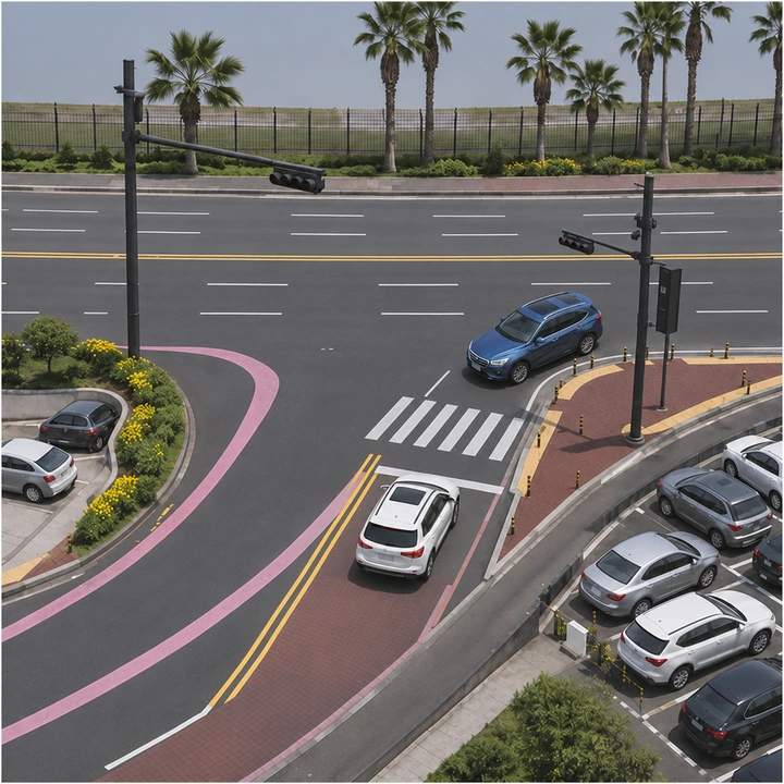
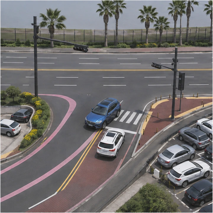
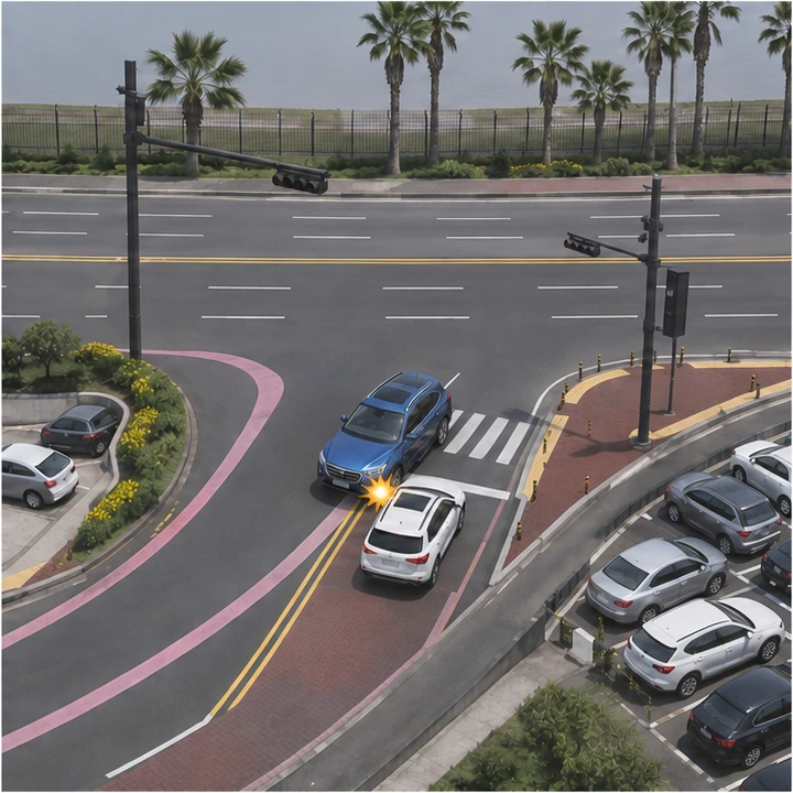
Illustrated scenario based on satellite imagery and April 2025 street views. Signal light states are omitted.
When turning left, stay clear of oncoming lanes.
Blue arrows show the approach direction. Red dots mark locations where extra care is needed.
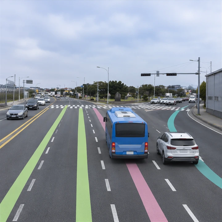

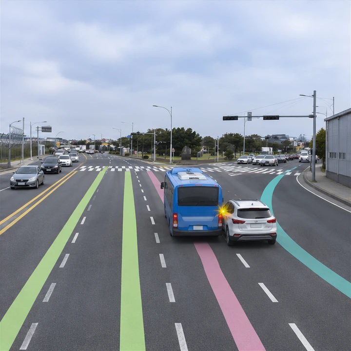
Illustrated scenario based on four approach lanes and guidance lines in satellite imagery and April 2025 street views. Signal light states are omitted.
Follow the straight-ahead and right-turn guide lines, and keep clear of vehicles beside you.
Blue arrows show the approach direction. Red dots mark locations where extra care is needed.
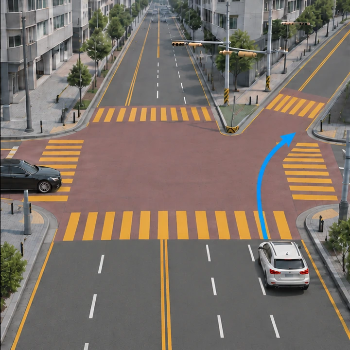
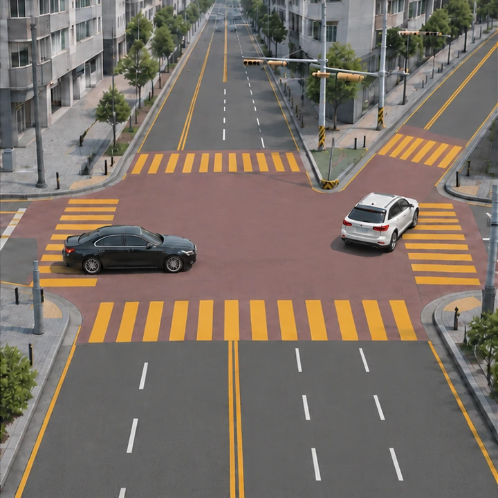
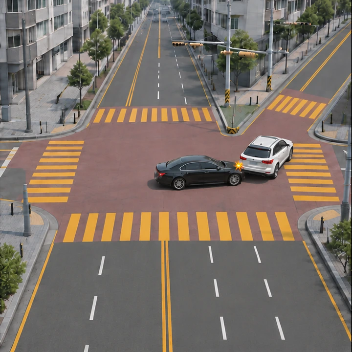
Illustrated scenario based on street views from September 2026. Signal light states are not shown.
Check which way you are going and which signal applies before entering.
Blue arrows show the approach direction. Red dots mark locations where extra care is needed.

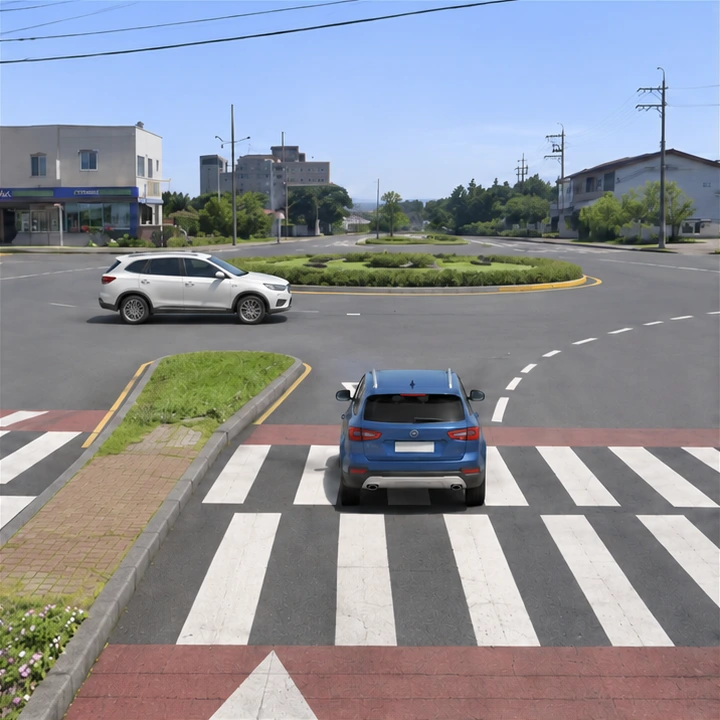
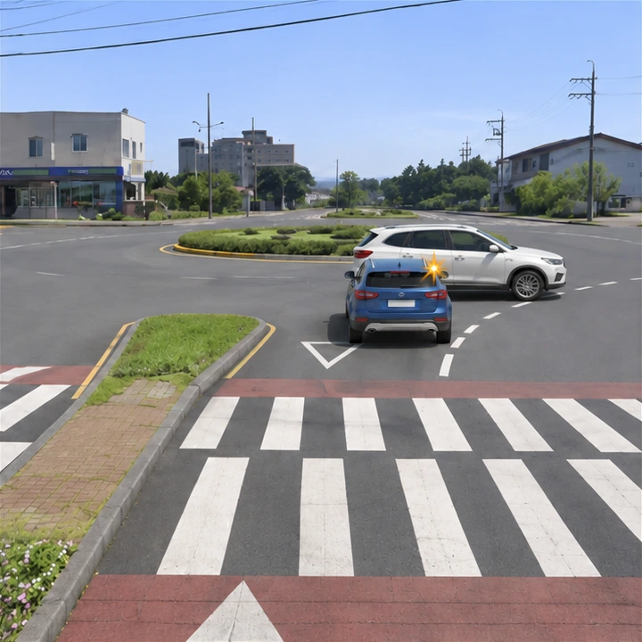
Illustrated scenario based on the splitter island, crossing and yield marking visible in April 2025 street views.
Slow down on the descent and yield to traffic already in the roundabout.
Blue arrows show the approach direction. Red dots mark locations where extra care is needed.
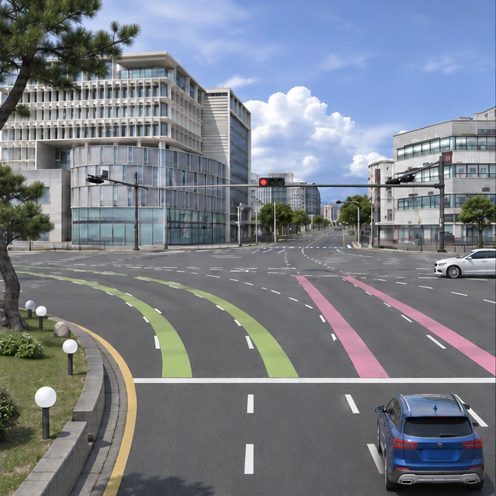

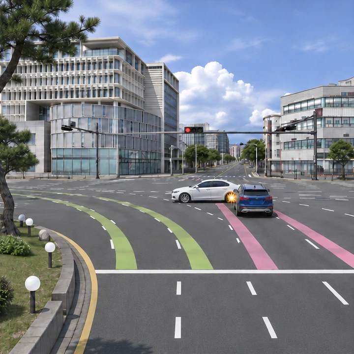
Illustrated scenario based on satellite imagery and September 2026 street views. The red light explains the example; it does not represent the actual signal cycle.
Check stop lines and signals for your direction inside the rotary.
Base maps © NAVER Map. The crash sequences are illustrations. Follow road signs and traffic signals on site.
This reference map does not show current closures or icy conditions.

The original notice says these roads ice over frequently. It requires snow chains and restricts small vehicles.
The original notice says some sections may ice over. Fit snow chains and drive with care.
Check snow chain requirements and restrictions for your vehicle before leaving, and follow instructions on site.
Check the vehicle and product manuals for tire sizes, chain compatibility and which wheels to fit them to.
Road restrictions may still apply when snow chains are fitted.
Avoid sudden acceleration, hard braking and sharp steering. Leave extra space. Once chains are fitted, follow the product’s speed limit.
Equipment questions: 064-744-1401 →Review the details for your booked vehicle and selected options, along with the terms provided at rental.
Call from a safe place using the number below.
For injuries or immediate danger,
call 112 or 119.